General
Clouds are a collection of water droplets or ice crystals, or a combination of these two states of water, suspended in the atmosphere.
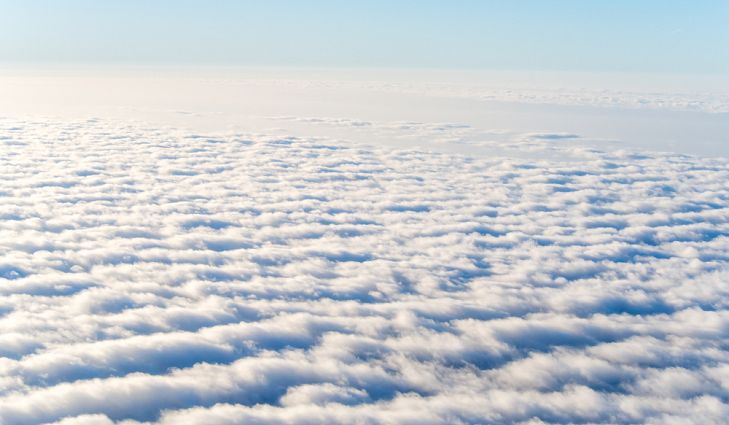
The temperature of the air decreases steadily with increasing altitude, but the amount of water vapor does not necessarily decrease with altitude. Thus, the relative humidity typically rises with altitude. If it rises to 100% at a certain level, clouds can form at and above that level, because condensation forms on airborne dust particles.
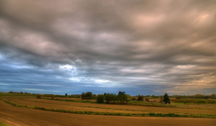
The development of clouds is accelerated by atmospheric updrafts, when moist air ascends to great heights. The higher the relative humidity, in general, the lower the altitude at which clouds begin to form. On a rainy day, clouds are usually observed at low altitudes, and in the extreme case, they form on the ground. Then they are called fog.
Meteorologists and aviators speak of the cloud ceiling (often simply called the ceiling). This is the altitude of the bottom of the lowest layer of clouds, measured with respect to either sea level or the earth’s surface. Clouds form in a variety of shapes and patterns. Meteorologists have several different classifications for tropospheric clouds. Clouds are named according to their relative altitude and their general shape. Clouds associated with weather at the surface occur at altitudes from sea level to the top of the troposphere. Nacreous clouds and noctilucent clouds form above the troposphere, and are not directly associated with weather at the surface.
Cloud Formation
Four Main Ways of Cloud Formation
- Turbulence
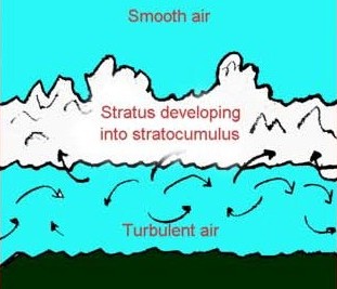
 : Strong winds blowing over uneven ground strike against various obstructions. This causes the air to deflect upwards. As the air rises, it gets cooled adiabatically. If cooled below the dew point, clouds will be formed. This happens when air is moisture laden and passes over cold, uneven ground. Over sea, wind speed of over 13 knots can produce sea waves of sufficient height to form turbulence clouds. These clouds are of the stratus type with base generally not more than 600m high.
 - Orographic Clouds :
 When a warm, moist wind blows against a mountain range, it begins to climb up the mountain side. During this ascent, it cools adiabatically and after cooling below its dew point, orographic clouds are formed. These are also of the stratus type. If the mountain is too high, then further ascent results in nimbostratus and continuous precipitation. On the windward side, clouds are forming steadily and on the leeward side, clouds are dissipating at the same rate as the descending air gets adiabatically warmed and clouds evaporate.
 - Convection :

Convection – Source: thoughtco
When a parcel of air gets heated, due to any local cause, it expands and becomes less dense than the surrounding air and hence, it rises. This is called convection current. This local heating can be due to contact with warm sea or ground. The parcel will rise till it is warmer than the surrounding air. During the ascent the rising air will get cooled adiabatically and when cooled below dew point, condensation takes place resulting in formation of convection clouds which are always of the cumulous type. If the ascent of air is high, it will result in formation of towering cumulus. If the ascent is very rapid, cumulonimbus clouds may form with its head well into the high cloud level until its top reaches the tropopause. As the cloud cannot rise above the tropopause it will spread sideways and look like an anvil. This is called an anvil shaped cumulonimbus.
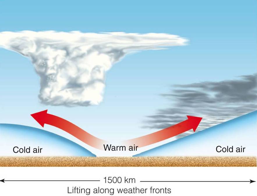
- Frontal Lifting :

Frontal Lifting – Source: apollo.lsc.vsc.edu
When a warm and cold mass of air are in contact, their line of separation at sea level is called a front. The boundary between them is non-vertical. It is inclined towards the colder air as it is denser than the warmer air. This inclined boundary acts like a wedge and lifts up the warm air. In case of a warm front, the slope is gradual and the upsliding warm air forms stratiform clouds. In case of a cold front, the slope is very steep and the upsliding warm air forms cumulonimbus and cumulus clouds.
 : Strong winds blowing over uneven ground strike against various obstructions. This causes the air to deflect upwards. As the air rises, it gets cooled adiabatically. If cooled below the dew point, clouds will be formed. This happens when air is moisture laden and passes over cold, uneven ground. Over sea, wind speed of over 13 knots can produce sea waves of sufficient height to form turbulence clouds. These clouds are of the stratus type with base generally not more than 600m high.
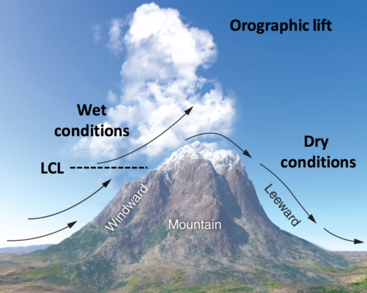 When a warm, moist wind blows against a mountain range, it begins to climb up the mountain side. During this ascent, it cools adiabatically and after cooling below its dew point, orographic clouds are formed. These are also of the stratus type. If the mountain is too high, then further ascent results in nimbostratus and continuous precipitation. On the windward side, clouds are forming steadily and on the leeward side, clouds are dissipating at the same rate as the descending air gets adiabatically warmed and clouds evaporate.
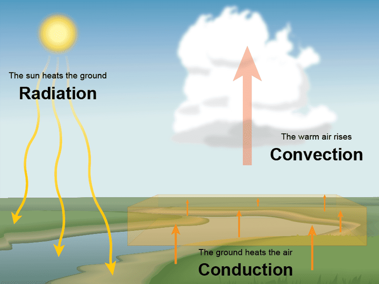
Types of clouds
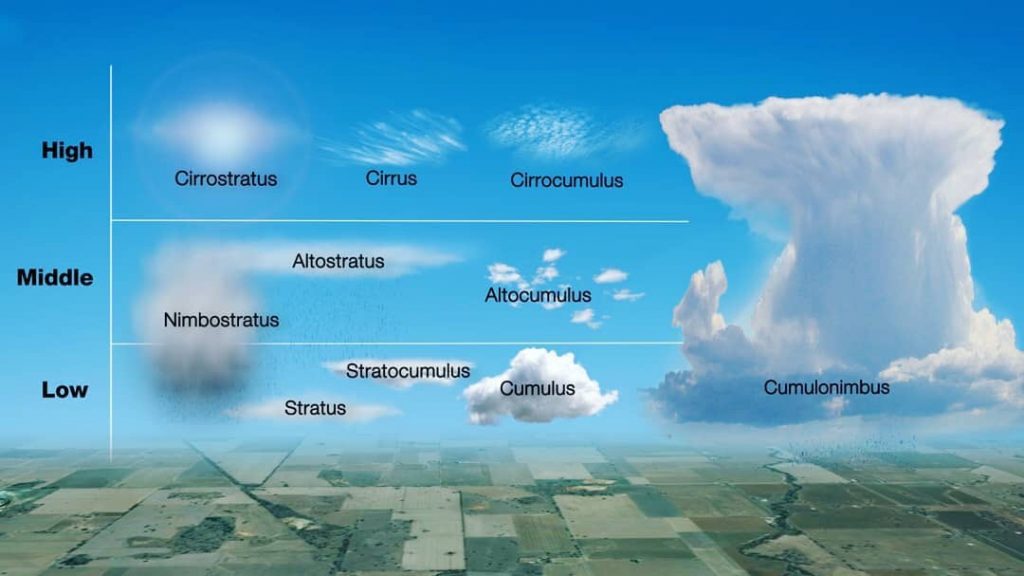
| Level | Designation | Type | Abbreviation |
| High>7000m | CH | Cirrus Cirrostratus Cirrocumulus | Ci Cs Cc |
| Medium >2000m and <7000m | CM | Altostratus Altocumulus Nimbostratus | As Ac Ns |
| Low <2000m | CL | Stratus Stratocumulus Cumulus Cumulonimbus | St Sc Cu Cb |
High-Altitude Clouds
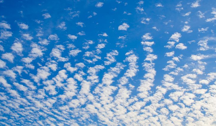
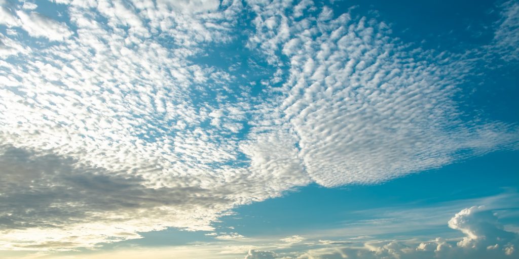
The highest tropospheric clouds range from altitudes of about 7 km (20,000 ft) to 18 km (60,000 ft) above sea level. They are named with words that begin with the prefix cirr– from the Latin word cirrus, meaning “curly.” Wispy, web-like cirrus clouds are commonly seen. High, smooth clouds are called cirrostratus. They give the sky a milky appearance and frequently cause a ring around the sun or moon. An old adage says that a ring around the sun or moon means rain or snow is on the way. This is often true. Low-pressure systems are commonly preceded by high, thin clouds such as cirrostratus. Some high clouds have a congealed or puffy look. These are known as cirrocumulus. They can cause partial or complete overcast.
Cirrus:
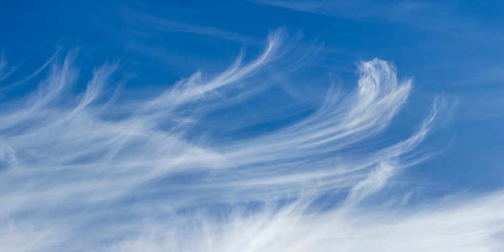
Cirrus, Source: metoffice.gov.uk
- These high clouds are silvery and appear like feathers or fibres.
- Being so high up they always have background of blue light. During twilight, they appear bright red or yellow.
- On dark nights, they have dimming effects on the stars.
Cirrostratus:
Cirrostratus, Source: metoffice.gov.uk
- These high clouds have thin whitish veil.
- Through these sun and moon appear watery. However, the outline of the sun or moon is sufficiently clear for altitude observations.
- Haloes are often seen.
Cirrocumulus:
Cirrocumulus, Source: worldatlas.com
- These high clouds are in the form of small flakes or cauliflower.
- They are white in colour and there is no shadow between them
Mid-Altitude Clouds
The mid-level clouds are between about 2 km (6000 ft) and 7 km (20,000 ft)
above sea level and are given the prefix alto-, which is Latin for “high.”
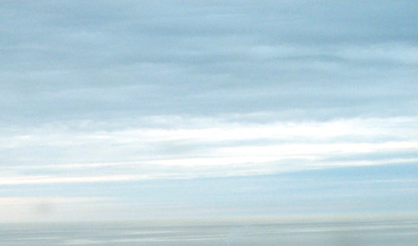
Mid-level clouds sometimes have a flattened appearance, in which case they are called altostratus. Altostratus clouds are lower and thicker than cirrostratus.
Mid-level clouds with a puffy look are known as altocumulus.
Altostratus:
Altostratus, Source: scied.ucar.edu
- it is a thin grayish blue veil of cloud with dark shadow like patches.
- Through them, sun and moon appear dim and their outlines appear hazy.
- It does not give rise to haloes.
Altocumulus:
Altocumulus, Source: metoffice.gov.uk
- It is white grey or both, in patch, layer or sheet form.
- It has dark shadows in between and appears like small flattened globules, rolls or long bands or almonds.
Nimbostratus:
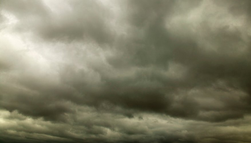
- It is an even layer of dark grey cloud.
- It is uniform and threatening in appearance.
- It has got a wet look and causes precipitation. (continuous, not intermittent)
- It is usually formed by gradual thickening and lowering of altostratus.
- It can completely obscure the sun and weaken day light.
Low-Altitude Clouds
The lowest clouds have bases at altitudes less than 2 km (6,000 ft). These clouds are sometimes given the prefix strat-. Low clouds sometimes extend all the way to the surface, in which case fog occurs. Low, flat clouds are called stratus clouds. If rain falls from them, they are called nimbostratus. Low, rolling, gray stratocumulus are seen on an overcast
but dry day typical of much of the United States in late autumn. The cotton like puffs of fair-weather cumulus are easy to recognize.
Stratus:
Stratus, Source: worldatlas.com
- It is an even layer of dark grey cloud.
- It does not cause precipitation and has got a dry look.
- It resembles fog but does not occur at sea level.
- It can obscure the sun totally and weaken day light.
Stratocumulus:
Stratocumulus , Source: worldatlas.com
- It is grey in colour with dark shadows.
- It has patches of globular masses.
- The patches join and form overcast sky obscuring the sun.
- It is distinguishable from stratus by its wavy and linear appearance.
Cumulus:
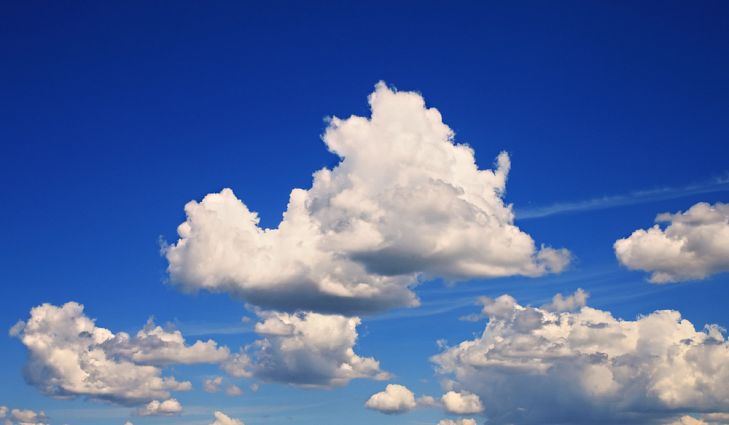
Cumulus, Source: worldatlas.com
- It is brilliant white in colour, with clear outline.
- It is a thick cloud with flat base and appears like cauliflower top.
- If it has little vertical accent it is called fracto cumulus.
- If it has high vertical accent then it is called towering cumulus.
- Well-developed cumulus will cause precipitation which is light.
Cumulonimbus:
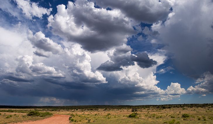
Cumulonimbus, Source: worldatlas.com
- It is grey and heavy cloud with great vertical extent.
- The base is in low cloud levels but the top is in high cloud level.
- It has a threatening appearance and also known as a thundercloud.
- The top of a well-developed cumulonimbus with have attached to it , a cap of white cirrus cloud in the shape of an anvil. It is thus called anvil shaped cumulonimbus. Its base however resembles a nimbostratus.
- It gives intermittent showers and hence can be distinguished from nimbostratus which gives continuous precipitation.
—————————
Still looking for easier concepts for understanding, I came across this Weather Wiz page. Hope it helps!
THE EXPLANATION WAS THE BEST I COULD FIND ON INTERNET