The International Association of Marine Aids to Navigation and Lighthouse Authorities (IALA) is a non-profit organization founded in 1957 to collect and provide nautical expertise and advice.
• Lateral marks indicate the edges of a channel.
• Cardinal marks indicate the direction of safe water at a dangerous spot.
• Safe water marks indicate the deep water and open end of a channel.
• Special marks indicate administrative areas, such as speed restrictions or water skiing areas.
• Isolated danger marks indicate a hazard to shipping.
Lateral Marks
Region A
Region A comprises nations in Europe, Australia, New Zealand, parts of Africa and most of Asia other than the Philippines, Japan and Korea.
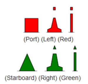
• Port marks are red and may have a red flashing light of any rhythm other than composite group flashing (2+1)
Colour: Red.
Shape: Can, pillar or spar.
Topmark (when fitted): Single red can.
Retroreflector: Red band or square.
• Starboard marks are green and may have a green flashing light of any rhythm other than composite group flashing (2+1)
Colour: Green.
Shape: Conical, pillar or spar.
Topmark (when fitted): Single green cone point upward.
Retroreflector: Green band or triangle.

PREFERRED CHANNELS
At the point where a channel divides, when proceeding in the conventional direction of buoyage, a preferred channel indicated by: 
Preferred channel to starboard
- Colour: Red with one broad green horizontal band.
- Shape: Can, pillar or spar.
- Topmark (when fitted): Single red can.
- Retroreflector: Red band or square.
Preferred channel to port
- Colour: Green with one broad red horizontal band.
- Shape: Conical, pillar or spar.
- Topmark (when fitted): Single green cone point upward.
- Retroreflector: Green band or triangle.
Region B
Region B comprises nations in North America, Central America and South America, the Taiwan, Philippines, Japan and Korea.
• Port marks are green and may have a green flashing light of any rhythm other than composite group flashing (2+1)
Colour: Green.
Shape: Can, pillar or spar.
Topmark (when fitted): Single green can.
Retroreflector: Green band or square.
• Starboard marks are red and may have a red flashing light of any rhythm other than composite group flashing (2+1)
Colour: Red.
Shape: Conical, pillar or spar.
Topmark (when fitted): Single red cone point upward.
Retroreflector: Red band or traingle.

PREFERRED CHANNELS
At the point where a channel divides, when proceeding in the conventional direction of buoyage, a preferred channel indicated by:
Preferred channel to starboard
- Colour: Green with one broad red horizontal band.
- Shape: Can. pillar or spar.
- Topmark (when fitted): Single green can.
- Retroreflector: Green band or square.
Preferred channel to port
- Colour: Red with one broad green horizontal band.
- Shape: Conical, pillar or spar.
- Topmark (when fitted): Single red cone point upward.
- Retroreflector: Red band or triangle.
Cardinal Marks
A cardinal mark is a sea mark (a buoy or other floating or fixed structure) used in maritime pilotage to indicate the position of a hazard and the direction of safe water.
Cardinal marks indicate the direction of safety as a cardinal (compass) direction (north, east, south or west) relative to the mark. This makes them meaningful regardless of the direction or position of the approaching vessel, in contrast to the (perhaps better-known) lateral mark system.
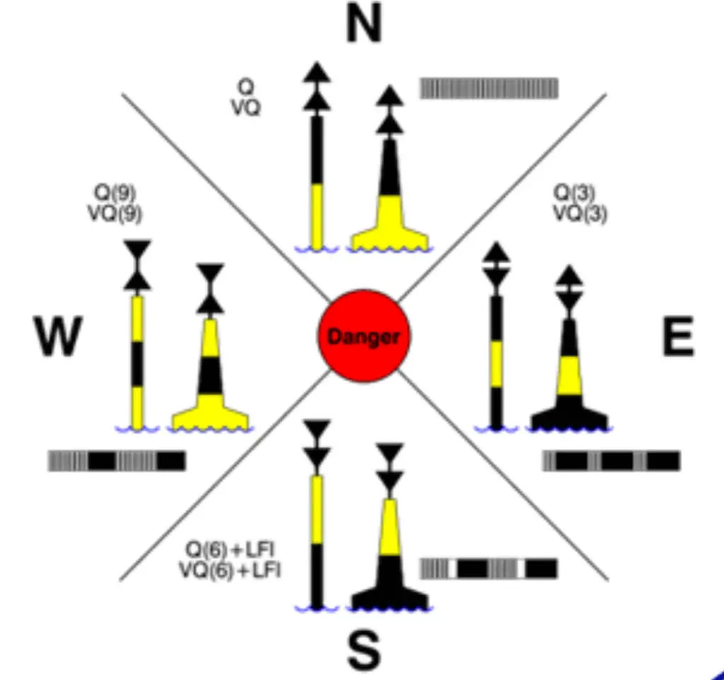
A cardinal mark indicates one of the four compass directions by:
• The direction of its two conical top-marks, which can both point up, indicating north; down, indicating south; towards each other, indicating west; or away from each other, indicating east
• Its distinctive pattern of black and yellow stripes, which follows the orientation of the cones – the black stripe is in the position pointed to by the cones (e.g. at the top for a north cardinal, in the middle for a west cardinal)
• Optionally, its distinctive sequence of flashing light, which consists of a sequence of quick or very quick flashes whose number gives the clockface position which corresponds to the direction of the cardinal (e.g. three for an east cardinal, nine for a west; north has continuous flashes, and south may be augmented with a long flash, to help distinguish it from a west in difficult conditions)

Safe Water Marks
It usually implies that open, deep and safe water lies ahead, though it is sometimes also used to indicate the start and end of a buoyed section of a continuous narrow channel, or a line of these marks can be used to mark a safe route through shallow areas.
The marker is also sometimes known as a Fairway Buoy.
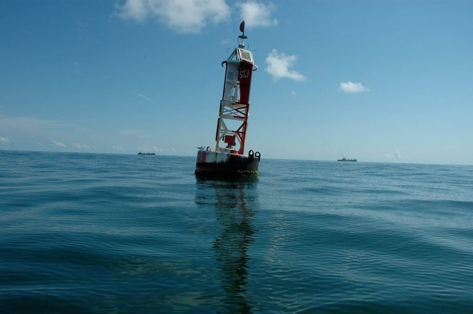
Colour: Red and White
Shape: Pillar or spar
Topmark: Red sphere
Retroreflector: Red and White


Special Marks
A Special Mark, as defined by the International Association of Lighthouse Authorities, is a sea mark used in maritime pilotage. It is recognisable by its yellow colour and X, (often referred to as a St. Andrews Cross) top-mark. It has a distinctive sequence of various flashes that does not match any other navigational mark flashes in its vicinity.
Colour: Yellow
Shape: Optional
Topmark: Yellow
Retroreflector: Yellow


Isolated Danger Marks
An Isolated Danger Mark, as defined by the International Association of Lighthouse Authorities, is a sea mark used in maritime pilotage to indicate a hazard to shipping such as a partially submerged rock.
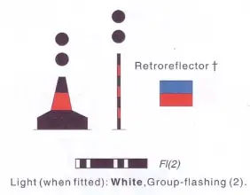
It is recognisable by its black and red bands and top-mark of two black balls. Its distinctive sequence of flashing light consists of 2 quick flashes with intervals of 5 seconds.
Colour: Black and Red
Shape: Pillar or spar (if a buoy)
Topmark: Two black spheres
Retroreflector: Blue and Red

Emergency Wreck Marking Buoy
The Emergency Wreck Marking Buoy, introduced by IMO on the recommendation of IALA, in 2006 (on trial until confirmed in 2010). is designed to provide a highly conspicuous visual and radio aid to navigation. It will be be placed as close to the wreck as possible, or in a pattern around the wreck, and within any other marks that may be subsequently deployed.
The Emergency Wreck Marking Buoy will be maintained in position until:
- The wreck is well known and has been promulgated in nautical publications i.e. Notices to Mariners.
- The wreck has been fully surveyed and exact details such as position and least depth above the wreck are known.
- A permanent form of marking of the wreck has been carried out.


very good and well written information especially for myself as I am a apprentice AB and have been looking for a well written but easy to understand article will definitely use again!!!
“Region A comprises nations in Europe, Australia, New Zealand, parts of Africa and most of Asia other than the Philippines, Japan and Korea.”
Parts of Africa? Looks more like all of Africa.
Taiwan is in IALA B region.
very well written and easily understood by me.
I would recommend other deck cadets to read this
Your narrative say that Tai Wan in Region B, but you map show it in Region A?